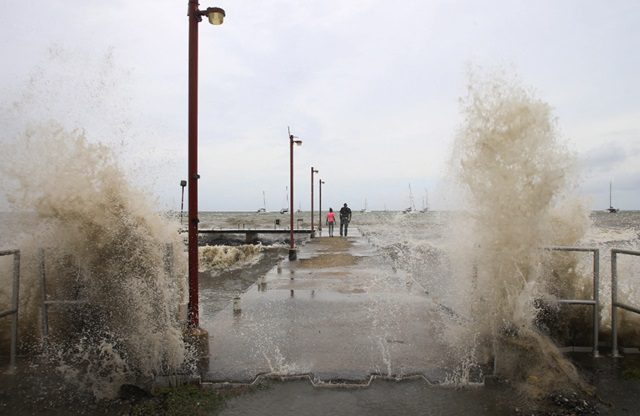
BTN News: Hurricane Beryl has quickly become a very strong and unusual storm. This shows that the Atlantic and Caribbean regions are facing serious weather conditions. Experts say that Beryl’s strength is a sign of a tough hurricane season ahead. This article looks at why Beryl grew so strong and what this means for the future.
Beryl Has Broken Many Records Before Hitting Land
Beryl has broken many records even before hitting land. The storm is acting like those seen during the peak hurricane season. The water temperatures are as warm as in September. Five hurricane experts told The Associated Press about these unusual conditions. Beryl became the earliest Category 4 hurricane with winds of at least 130 mph (209 km/h). It is also the first of its kind in June. In just 48 hours, it grew from a tropical depression to a strong Category 4 hurricane. The winds increased by 63 mph (102 km/h) in only 24 hours.
On Monday night, Beryl became even stronger, reaching Category 5. This made it the first Category 5 hurricane in the Atlantic in July since Hurricane Emily in 2005. Category 5 hurricanes have winds over 157 mph (252 km/h), making Beryl a very rare storm.
Beryl’s Path is Unusual and Its Impact is Severe
Beryl is moving in a very southern path for such a strong hurricane, said Kristen Corbosiero from the University of Albany. On Monday, it hit Carriacou island with winds up to 150 mph (240 km/h). It is expected to affect the southeastern Caribbean islands. Forecasts say Beryl may stay strong for another day before getting weaker.
Jeff Masters, co-founder of Weather Underground, called Beryl an unusual storm. “It’s so far out of climatology that you look at it and say, ‘How could this happen in June?’” he said. Meteorologists had predicted a harsh year. They compare it to the record-setting 1933 and deadly 2005 seasons, which included hurricanes like Katrina and Rita.
Brian McNoldy, a tropical climate researcher at the University of Miami, said this year’s conditions are set for unusual and strong storms. “We expect more storms like Beryl this year, forming and getting stronger in unexpected places,” McNoldy said. The conditions not only help form and strengthen storms but also make quick growth more likely.
Future Implications and Expert Opinions About Beryl
Phil Klotzbach from Colorado State University sees Beryl as a sign of more strong storms to come. The water temperature around Beryl is 1 to 2 degrees above normal at 84°F (29°C). This is perfect for hurricanes. Warm waters help storms grow. Corbosiero explained that warmer water and air at the storm’s base make deep storms more likely.
Sea surface temperatures in the Atlantic and Caribbean are higher than the average for the past 30 years. Ocean heat content, which measures deeper water temperatures needed for storms, is also at record levels. “With all this heat energy, we can expect some ‘fireworks,’” Masters said.
This year, there is a big temperature difference between the warm ocean waters and the cooler upper atmosphere. This increases the chance of storm formation and strengthening. Kerry Emanuel from MIT said the Atlantic is warmer compared to the rest of the tropics than ever before.
Since March 2023, the Atlantic has been unusually warm. It set heat records since April 2023. A collapsed high-pressure system that usually cools with trade winds has not returned, making things worse.
Corbosiero said scientists are discussing what climate change does to hurricanes. They agree it makes quick strengthening more likely and increases the number of strong storms. The slowing of Atlantic ocean currents, likely due to climate change, may also warm the waters. The arrival of La Niña, a cooling pattern in the Pacific, tends to reduce wind shear that usually weakens hurricanes. This could lead to more hurricanes in the Atlantic and fewer in the Pacific.
On Sunday night, Beryl had an eyewall replacement cycle, which usually weakens the storm. But Beryl quickly became strong again, showing how unusual it is.
Conclusion
Hurricane Beryl’s rapid growth and record strength show a tough hurricane season ahead. Experts predict more strong and unusual storms. The Atlantic and Caribbean regions must prepare for serious weather. Warm waters, favorable conditions, and climate change factors make this year especially challenging.


